Texas landowners who may be affected by the Gulf Coast Midstream pipeline project should understand that the project is still in its early stages. While preliminary maps and project information are now available, the exact pipeline route may continue to change as engineering, surveying, and project planning move forward.
If you own property near the proposed route, this is an important time to learn about the project, understand the pipeline development process, and become familiar with your rights before signing documents or agreements.
What Is the Gulf Coast Midstream Pipeline Project?
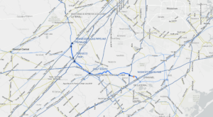
Gulf Coast Midstream Partners has released information about its proposed pipeline project, including a general project map and development timeline.
The maps provide landowners with an idea of the general area the project may cross, but they should not be considered precise representations of the final pipeline route.
At this stage, the company appears to still be working through engineering, design, surveying, and route development.
In other words, the company may know the general starting and ending points of the project, but the exact path between those locations may not yet be finalized.
Is the Pipeline Route Final?
No. The currently available route should be considered preliminary.
This is one of the most important things for landowners to understand.
Online project maps, including interactive maps, can be useful for determining whether a property may potentially be affected. However, those maps generally do not show the final surveyed centerline with the level of accuracy necessary to determine exactly where a pipeline will cross an individual property.
For example, a preliminary map may appear to show a pipeline passing directly through a home, barn, business, or other structure.
That does not necessarily mean the final pipeline will be constructed in that exact location.
Pipeline companies generally attempt to avoid homes and certain structures when establishing a final route. Nevertheless, avoiding a residence does not necessarily mean the project will avoid the property altogether.
The pipeline could still cross another portion of the property or be placed in a location that creates concerns for the landowner.
What Stage Is the Gulf Coast Midstream Project In?
Based on the project information currently being provided, the Gulf Coast Midstream Partners project appears to remain in the early engineering, design, surveying, and route-development stages.
For landowners, this stage can be particularly important.
Many people assume they do not need to pay attention until they receive an offer for a pipeline easement. In reality, important decisions and communications can occur much earlier.
What Should I Do If I Receive a Pipeline Survey Request?
A survey request does not necessarily mean that the final pipeline will cross your property.
However, it does mean that your property may be under consideration.
Before signing a survey permission form or other document, carefully review what you are being asked to authorize.
Contact an attorney who specializes in Eminent Domain/Condemnation matters to guide you through the process.
Related Links
- Gulf Coast Midstream-Nash Storage Hub Pipeline Alert: What Texas Landowners Should Know About Survey Requests
- Gulf Coast Midstream website and interactive Map
- Diagram of the Steps in the Texas Condemnation Process
- Introduction to the Condemnation Process Steps
- Step 1A in the Condemnation Process
- Step 1B in the Condemnation Process

Call 800-266-4870 or text 979-320-9320 for an appointment. We can also arrange for online and telephone appointments all over Texas.